Россия, Сергиев Посад


СДЕЛАЙТЕ СВОИ УРОКИ ЕЩЁ ЭФФЕКТИВНЕЕ, А ЖИЗНЬ СВОБОДНЕЕ
Благодаря готовым учебным материалам для работы в классе и дистанционно
Скидки до 50 % на комплекты
только до
Готовые ключевые этапы урока всегда будут у вас под рукой
Организационный момент
Проверка знаний
Объяснение материала
Закрепление изученного
Итоги урока
Была в сети 20.11.2024 13:18

Джим Наталия Викторовна
Филолог, преподаватель
 972
 69 854

Местоположение
Специализация
Methods of cadastre planning
Категория:
Английский язык
05.01.2022 23:13

Просмотр содержимого документа
«Methods of cadastre planning»
Methods of cadastre planning
Подготовил: студент 3 курса
Гр. СЗО-091
Гаджиев Рахман Адиль оглы
Проверила: Джим. Н. В.
Work & surveying methods
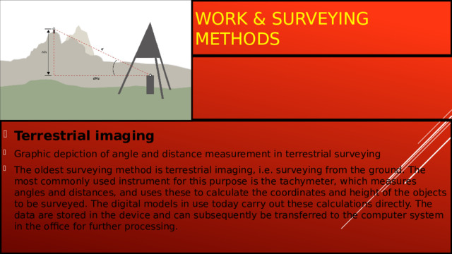
- Terrestrial imaging
- Graphic depiction of angle and distance measurement in terrestrial surveying
- The oldest surveying method is terrestrial imaging, i.e. surveying from the ground. The most commonly used instrument for this purpose is the tachymeter, which measures angles and distances, and uses these to calculate the coordinates and height of the objects to be surveyed. The digital models in use today carry out these calculations directly. The data are stored in the device and can subsequently be transferred to the computer system in the office for further processing.
Levelling
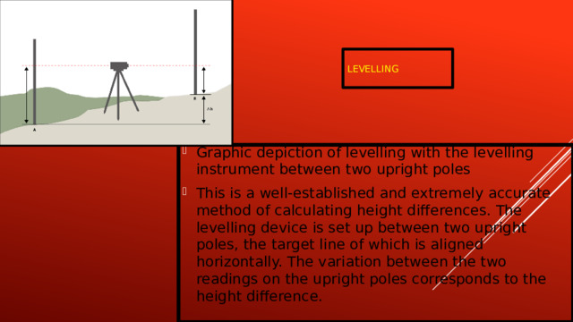
- Graphic depiction of levelling with the levelling instrument between two upright poles
- This is a well-established and extremely accurate method of calculating height differences. The levelling device is set up between two upright poles, the target line of which is aligned horizontally. The variation between the two readings on the upright poles corresponds to the height difference.
Global navigation satellite systems (GNSS)
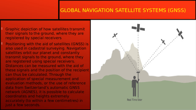
- Graphic depiction of how satellites transmit their signals to the ground, where they are registered by special receivers
- Positioning with the aid of satellites (GNSS) is also used in cadastral surveying. Navigation satellites orbit our planet and constantly transmit signals to the ground, where they are registered using special receivers. Distances can be measured with the aid of these signals and the position of the recipient can thus be calculated. Through the application of special measurement and evaluation methods, or the use of reference data from Switzerland’s automatic GNSS network (AGNES), it is possible to calculate coordinates and heights extremely accurately (to within a few centimetres) in just a few seconds.
Photogrammetry
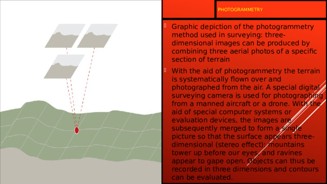
- Graphic depiction of the photogrammetry method used in surveying: three-dimensional images can be produced by combining three aerial photos of a specific section of terrain
- With the aid of photogrammetry the terrain is systematically flown over and photographed from the air. A special digital surveying camera is used for photographing from a manned aircraft or a drone. With the aid of special computer systems or evaluation devices, the images are subsequently merged to form a single picture so that the surface appears three-dimensional (stereo effect): mountains tower up before our eyes, and ravines appear to gape open. Objects can thus be recorded in three dimensions and contours can be evaluated.
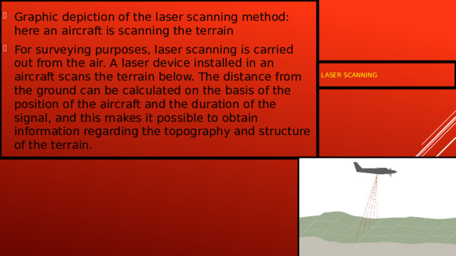
- Graphic depiction of the laser scanning method: here an aircraft is scanning the terrain
- For surveying purposes, laser scanning is carried out from the air. A laser device installed in an aircraft scans the terrain below. The distance from the ground can be calculated on the basis of the position of the aircraft and the duration of the signal, and this makes it possible to obtain information regarding the topography and structure of the terrain.
Laser scanning

THANK FOR YOUR ATTENTION




Вебинар для учителей
🎓 Свидетельство об участии ✨БЕСПЛАТНО!✨